LARGE
FORMAT SCANNERS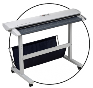

West Virginia is outpacing many other U.S. states with its geographic information system (GIS) database of state maps. With the majority of its archive digitally available, state workers and partners, for example, are benefitting from easily accessible mapping data for infrastructure projects. Likewise, mountain hikers and forestry service rangers can easily reference the online data for new and updated trails.
Thanks to the West Virginia State GIS Tech Center, located at West Virginia University, the state’s hardcopy maps are digitized and geo-referenced. However, it wasn’t too long ago that geographic information was only available in hardcopy form, stored in drawers, and starting to deteriorate over time.
Almost three decades ago, the State GIS Tech Center was established to provide focus, direction, and leadership to users of GIS, digital mapping, and remote sensing within the State of West Virginia. Since then, the Center has been involved in projects ranging from floodplain mapping to updates for the National Hydrography Dataset. The Center also facilitates GIS web map applications for the State Historic Preservation Office, West Virginia Trail Inventory, and others.
Populating an online GIS starts with digitizing valuable information from new and historic documents. It’s a role that large format scanners play, but only certain ones can handle the volume of scans, year after year, that is demanded by the West Virginia State GIS Tech Center — more than 300,000 and counting. The GIS Tech Center’s team recognized that its existing large format scanner simply lacked the throughput, power, and durability that was required for all its scanning projects. 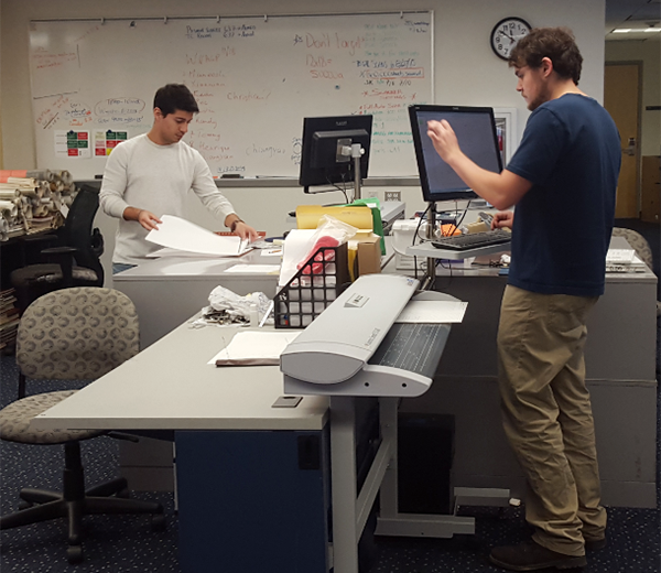 Also, one scanner was not enough.
When the scanner reached its end of life, the team turned to Paradigm Imaging Group, a distributor of large format solutions, who recommended two Colortrac SmartLF 42-inch large format scanning solutions.
“The Colortrac scanners significantly increased our throughput, reducing the cost per sheet scanned. This is important given the vast number of documents that we scan. In addition to throughput, the Colortrac scanners are proving to be durable. The plans we process have not all been stored in ideal conditions, and some were exposed to water and smoke damage. We do our best to remove contaminants while preserving document content and quality, but we can’t get rid of all the dirt, and the scan glass and other components hold up well in the face of this abuse. We do need to replace the scan glass and roller assembly every one to two years. Fortunately we benefit from the skilled support engineers at our regional vendor, Print-O-Stat, to perform this service and keep the scanners in top form,” notes Eric Hopkins, Lead GIS Specialist at the Center.
The scanning process is quick. Staffers clean maps and documents as necessary, then scan the documents and archive the originals. Staffers use Colortrac’s SmartWorks Pro software with the touchscreen interface to manage the scanning steps and to automatically number and name the plans.
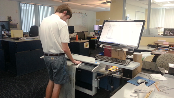
“It’s nice to have the automation built in,” comments Hopkins. Once the scan is complete, staffers transfer the image to another computer for processing. Using Adobe Photoshop and Acrobat Pro, they take out potential artifacts. Finally, the index map for each plan set is geo-referenced.
As of February 2021, the GIS Center has scanned more than 300,000 documents with the Colortrac scanners since purchasing them in 2015. Nearly 10,000 plan sets are available in multiple databases on the Plans Locator website.
Hopkins recommends setting up standard operating procedures (SOPs) at the outset of any major scanning initiative. “It’s invaluable for new people coming on board. You could pick up the manual and start working on the project,” he notes. “Our procedures manual for the scanning project has evolved. We worked out the process, recorded it, and developed standards, including throughputs and bit depth. Documenting our procedures and keeping it up to date has been beneficial.”
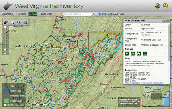
Screenshot from West Virginia Trail Inventory – just one of the digital tools made from the scanning of archived maps. Take a look: https://mapwv.gov/mtrails/

Orange, CA – March 13, 2025 – Paradigm Imaging Group , a leading distributor of large format scanners, sign equipment, and multifunction systems, shares how the […]

Orange, CA – March 18, 2024 – Paradigm Imaging Group, the North American Distributor of Colortrac scanners, announces the introduction of the New Colortrac SmartWorks Imaging […]

ORANGE, CA – March 28, 2023 Paradigm Imaging Group, a leading provider of large format solutions, is proud to announce an increase in sales for their […]

Orange, CA – November 3, 2022 – Paradigm Imaging Group announces a huge price breakthrough in Flatbed scanners with the introduction of the NEW MicroTek LS-4600 […]

West Virginia is outpacing many other U.S. states with its geographic information system (GIS) database of state maps. With the majority of its archive digitally available, […]